Island of Sant'Erasmo
This article is about the island of Sant'Erasmo.
For the definition of an island in the context of the Venice Project Center's work, refer to the Island and Islands pages. For more generalized information on Major Lagoon Islands, see Major Lagoon Islands.
 | |
| Basic Information | |
| Codice | |
| ID Number | |
| Sestiere | |
| Usage | |
| Handicap Accessible | |
About
Sant'Erasmo was originally a lido of Venice but has since evolved into a lagoon island. Today it is used as a farm.'
Sant'Erasmo is a Major Lagoon island, and is located in sestiere of Sant'Erasmo.
Accessibility
Sant'Erasmo has the following boat stop(s): Sant'Erasmo Capannone, Sant'Erasmo Chiesa, Sant'Erasmo Punta Vela.
These boat stop(s) can be accessed using line(s): 13, 18
Dimensional Data
The island of Sant'Erasmo is located at the following coordinates:
Latitude: 45.457406° N
Longitude: 12.408883° E
Sant'Erasmo has a perimeter of 19143 meters and a surface area of 3248826 square meters.
Demographic Data
According to the 2011 census, Sant'Erasmo has a total population of 693 people, with a population density of 213.3078 people per square kilometer.
Interactive Media
Please click here to view this island within the Isolario Interattivo application.
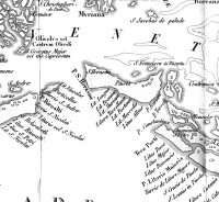
Map
See Also
References
All references associated with this island can be found in its corresponding Zotero page